Orientation by sun and stars is a foundational skill for any adventurer, camper, scout or survivalist who may need to navigate without batteries, satellite signals or electronic devices. This guide covers proven, low-tech methods you can apply in the field, explains how and when to use each technique, and highlights the main challenges you may face.
Why learn natural navigation?
Being able to navigate with the sky increases your resilience in the outdoors. Even if you carry a compass and GPS, natural navigation helps when equipment fails, batteries die or you lose the device. It also improves situational awareness, deepens your connection to the environment and is a valuable skill to teach others.
Basic principles: azimuth, elevation and local noon
Before diving into techniques, understand three key concepts:
- Azimuth – the compass bearing of an object on the horizon measured in degrees from true north (0°).
- Elevation – the angle above the horizon of a celestial object (stars or sun).
- Local solar noon – when the sun reaches its highest point in the sky for your location and crosses the local meridian; at that moment the sun is due south in the Northern Hemisphere and due north in the Southern Hemisphere (true direction, not magnetic).
Reliable references for solar calculations: NOAA Solar Calculator and the U.S. Naval Observatory.
Daytime techniques
1. Shadow-stick method
The shadow-stick is simple, fast and works with no instruments. You need a straight stick (~30–60 cm) and a patch of level ground:
- Place the stick vertically in the ground and mark the tip of its shadow with a small stone or twig (Point A).
- Wait 10–15 minutes and mark the new position of the shadow tip (Point B).
- Draw a straight line between A and B — this line points roughly west to east (A = west, B = east in the Northern Hemisphere during morning-to-afternoon progression).
- Perpendicular to that line gives you north-south orientation (verify hemisphere: in Northern Hemisphere, south is toward the sun at local noon).
Accuracy: reasonable for general orientation (±10–20°) if you allow enough time and place the stick vertically. For more precision lengthen the interval between marks.
2. Watch method (analog)
If you have an analog watch, you can approximate cardinal directions:
- Northern Hemisphere: point the hour hand at the sun; the midpoint between the hour hand and 12 o’clock points south.
- Southern Hemisphere: point the 12 o’clock toward the sun; the midpoint between 12 and the hour hand points north.
Adjust for Daylight Saving Time by using 1 o’clock instead of 12. This method is quick but less accurate near sunrise/sunset and during polar summers.
3. Using sunrise and sunset bearings
On any given day, the sun rises roughly in the east and sets roughly in the west, but the exact azimuth shifts with season and latitude. If you can observe the precise point of sunrise or sunset on the horizon, you can establish an approximate east-west line and then get north-south from that.
For exact sunrise/sunset azimuths for your location and date, consult tools like NOAA’s solar calculator.
Night-time techniques
Stars are stable navigational references. Night methods are especially useful when the sun is not visible.
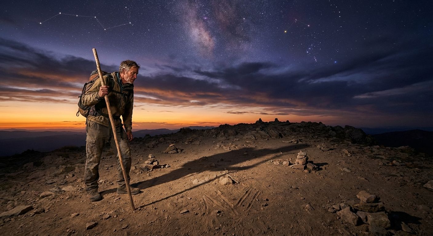
1. Finding north with Polaris (Northern Hemisphere)
Polaris (the North Star) sits nearly over the North Celestial Pole, so it indicates true north. How to find Polaris:
- Locate the Big Dipper (Ursa Major) — the two stars at the end of the dipper’s bowl (Dubhe and Merak) point toward Polaris. Follow the line through them about five times the distance between the two pointer stars.
- Confirm using Cassiopeia: the ‘W’ shaped pattern sits opposite the Big Dipper across Polaris.
Once you find Polaris, face it: you are facing north, behind you is south, left is west and right is east. Polaris’s elevation above the horizon approximates your latitude (for example, Polaris at ~45° elevation indicates ~45°N latitude).
Reference: Polaris (NASA/Wikipedia overview).
2. Southern Hemisphere: Southern Cross & pointers
There is no bright star exactly at the south celestial pole, but you can use the Southern Cross (Crux) and the bright pointers (Alpha and Beta Centauri):
- Extend the long axis of the Southern Cross about 4.5 times from the tip of the cross to a point on the sky — that approximates the south celestial pole.
- Alternatively, draw a perpendicular bisector between the two bright pointer stars (Centauri) and use it in combination with the cross to estimate south.
Face that point and you face south. Confirm with local horizon features if available.
3. Using constellations as a star-compass
Experienced navigators memorize approximate azimuths of key stars and constellations across seasons. Examples:
- Orion (belt points roughly east-west when rising/setting).
- Sirius is useful in winter skies in the Northern Hemisphere, near southeast to south depending on time.
A star chart app or printed planisphere used in training can help build this mental map; practice under clear skies until orientation becomes intuitive.
Practical tips and drills
- Practice routinely in familiar terrain. Try shadow-stick, watch method and Polaris identification on separate nights and days until you can perform each method quickly.
- Use landmarks—ridges, rivers and trails—to cross-check celestial fixes.
- Combine methods for better accuracy: use the sun in the day and Polaris at night to confirm bearings.
- Keep a simple notebook with sketches and remembered azimuths for your favorite routes.
Common challenges and limitations
Understanding limitations helps avoid mistakes. Common issues include:
1. Cloud cover and bad weather
Heavy clouds or storms obscure sun and stars. In prolonged overcast, use terrain features (drainage, vegetation growth) and stay put or follow established trails until visibility improves.
2. Polar and high-latitude complications
Near the poles during summer, the sun may not behave as a clear east-west indicator (midnight sun). In extreme latitudes, star positions are circumpolar and require special knowledge; standard watch and shadow methods become unreliable.
3. Light pollution and horizon obstructions
In urban or forested areas, haze, trees and light pollution can hide key stars or distort the apparent sunrise/sunset point. Move to a clearing or higher ground for a better sightline.
4. Magnetic vs true north confusion
Celestial methods point to true north/south (geographic poles). If you also use a magnetic compass, remember to apply magnetic declination for your location to convert between magnetic and true bearings. See USGS maps or local resources for declination values.
5. Accuracy limits
Natural navigation generally provides coarse bearings (often ±5–20°). It is excellent for route-finding and reorientation but not for pinpoint surveying. When accuracy is critical, combine natural methods with a compass, map and GPS.
Safety, gear and training recommendations
- Bring a small field guide or laminated star chart and learn major constellations before heading out.
- Carry a watch (analog recommended for the watch method) and a simple folding ruler or staff for shadow sticks.
- Practice estimating angles with your fist and hand: at arm’s length, a fist is roughly 10° – a quick skill for estimating star elevation.
- Enroll in a navigation or wilderness survival course to practice under expert supervision.
External training resources: REI Navigation Basics, National Park Service.
Simple field exercises (step-by-step)
- Shadow-stick check: place a stick and mark two shadow tips 15 minutes apart. Confirm east-west and derive north-south.
- Night sky drill: identify the Big Dipper and Polaris. Face Polaris and walk a known bearing for 100 meters, then confirm on a map.
- Sun-watch test: at mid-afternoon, use your watch method and compare to a compass reading adjusted for declination.
Log results and times—practice under different seasons and latitudes to see how methods shift.
Conclusion
Mastering orientation by sun and stars gives you dependable navigation skills that work when technology fails. Learn the shadow-stick, watch method, solar noon concepts and star-based techniques (Polaris, Southern Cross, star compass). Pair practice with good judgment about weather, terrain and accuracy limits. With consistent practice you’ll gain confidence to navigate reliably in most natural settings.
Final reminder: natural navigation is a complement, not always a replacement, for maps, compass and GPS—use all tools available and prioritize safety.